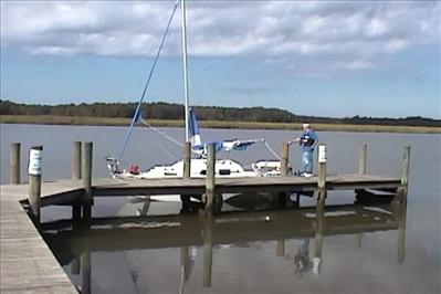
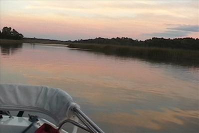
My dad and my West Wight Potter P-19 at the dock at Hoopes Landing on the Warrick River, just before we cast off and get underway.
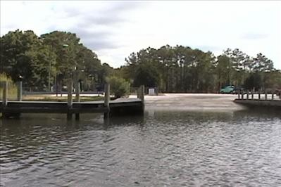
Looking back at the dock you can see the parking lot is pretty much empty; my truck is just visible in this picture.
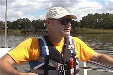
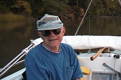
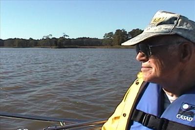
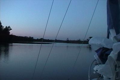
I have the helm and we are under power at 4.7 mph
|
|
|
|
|
|
|
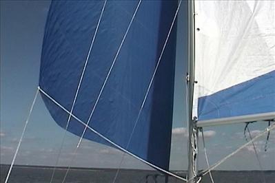
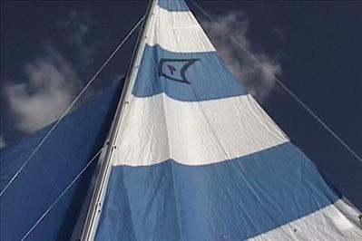
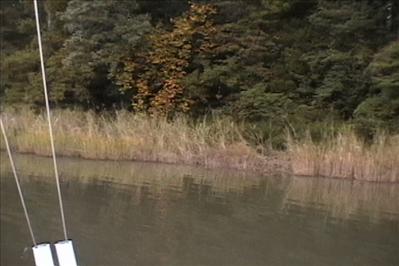
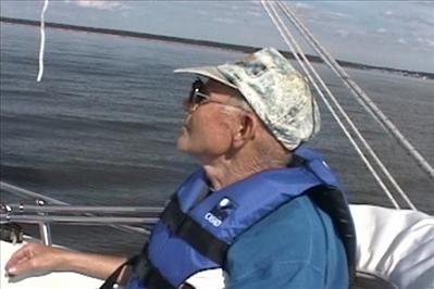
Once we are in the James we put the sails up. There wasn't much wind and it was directly behind us so I tried my luck doing wing-and-wing sailing. Worked pretty well but requires a lot of attention. After about an hour the wind completely died and since we were already behind we decided to motor for awhile to make sure we made our destination of Jamestown Island before dusk.
|
|
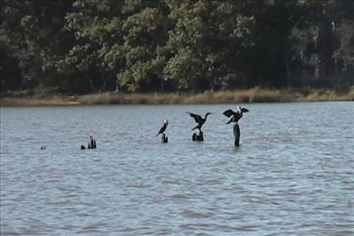
When I first posted the picture below I wasn't sure what kind of birds they were. Pat Murphy (participates on the West Wight Potters users group) sent me the following: "The birds you showed as "Hingas?" are either anahingas, also called water turkeys and snake birds, or cormorants. The two species are closely related and easy to confuse with each other. The former are common in the deep South, the former farther north, and there are many places where you find both." Thanks Pat.
|
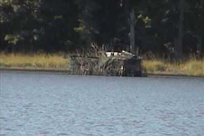
One of the many duck blinds that we saw.
|
We have arrived at Jamestown Island at around 6:30PM. We anchored in the Thoroughfare, pretty close to the visitors center. We were well screened behind a nice stand of trees and since it was after hours we knew it would be nice and quiet.
|
|
|
|
|
|
|
|
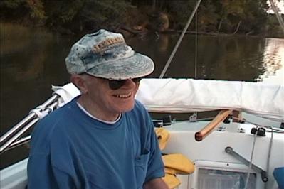
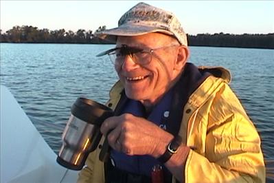
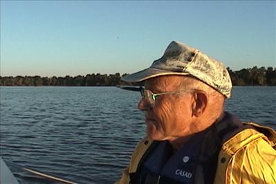
It's dinner time and it looks like Dad is in pretty good spirits.
|
|
|
|
|
|
|
|
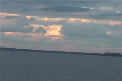
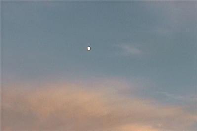
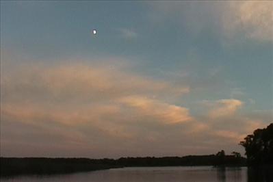
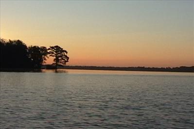
The sun was setting just as we anchored and there was a beautiful moon already visible.
|
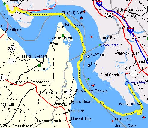
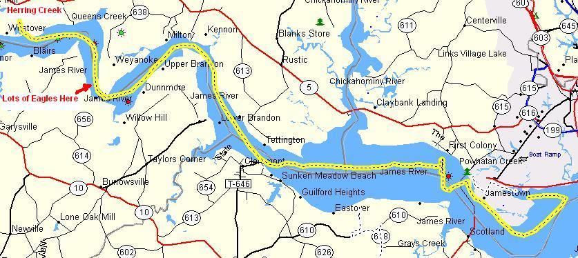
The track below shows our progress on day one. We covered 26.1 miles, averaging about 3.8 mph; total time was about 8 hours.
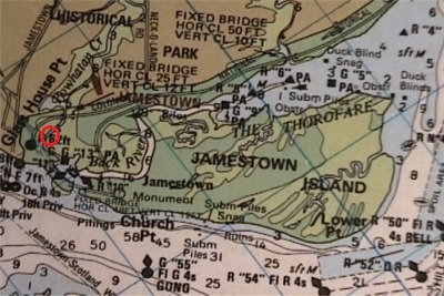
The red circle shows where we anchored.
Thursday
We were pretty slow moving the first morning; it is 8:30 AM before we have finished breakfast and are underway.
|
|
|
|
|
|
|
We are now on our way out of the Thoroughfare at Jamestown Island
|
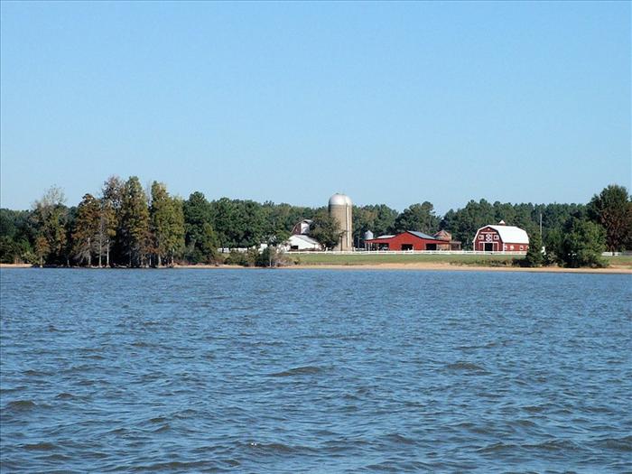
Here's a farm that looked very pretty.
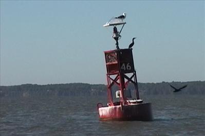
One of the channel markers we passed after we exited the Thoroughfare and made our way into the James River.
|
|
|
|
|
|
|
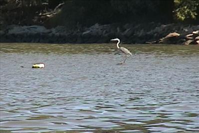
Here is a Blue Heron that was close to shore on Jamestown Island. We are just coming around the south side of the island and heading toward the monument area
|
|
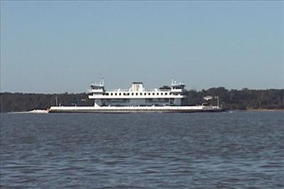
The ferries run fast and furious. It looked like there were four of them running about every fifteen minutes.
|
|
|
|
|
|
|
|
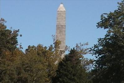
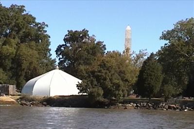
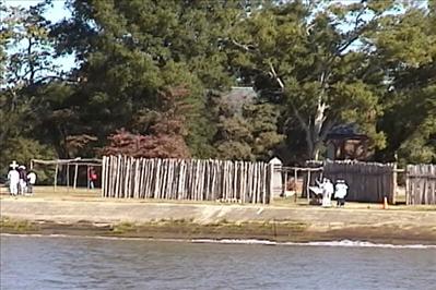
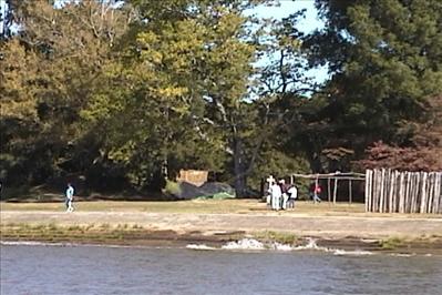
The pictures below show what we could see the original settlement area of Jamestown. The white dome below is sheltering an archeological dig that is in progress. It's been a few years since I was here last and after seeing the island from the water, it made me want to come back and see all of the settlement area. |
|
|
|
|
|
|
|
|
It's difficult to see in these pictures but through the trees is the Bruton Parish church. I'm not sure of the actual age but it is quite old
|
|
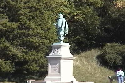
Here is the statue of Captain John Smith as he looks over the James. I was thinking about what it must have been like for him when he first arrived at Jamestown Island. It is incredible what the people of those times undertook and from the stories of the day they just took it all in stride.
|
|
|
|
|
|
|
|
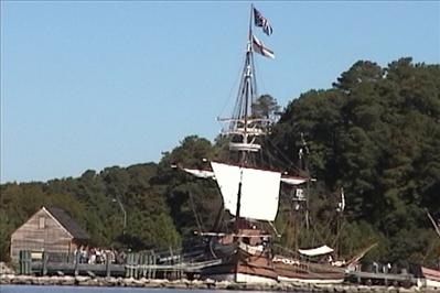
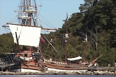
The Jamestown ship replicas.
|
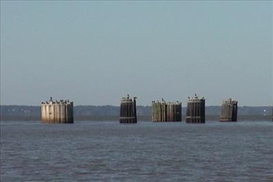
Pilings that the ferries tie up against.
|
|
|
|
|
|
|
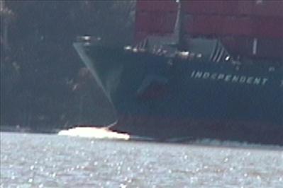
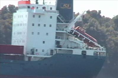
Here is a freighter we passed in the James River. The orange thing on the back was a boat
|
|
|
|
|
|
|
|
|
|
|
|
|
|
|
|
|
|
|
|
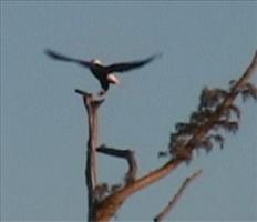
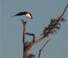
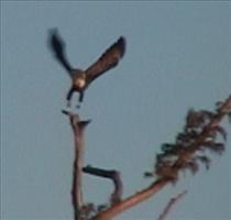
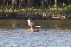
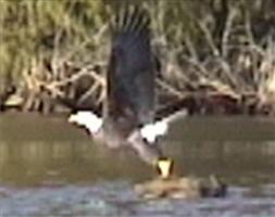
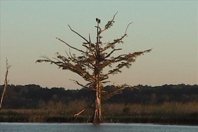
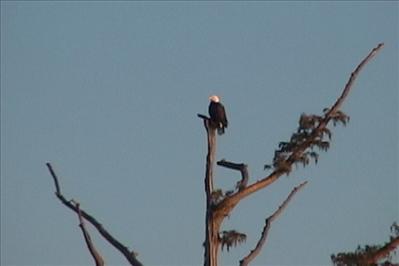
At this point, we are well up the James. We have passed the Chickahominy River and are heading up to view "Plantation Row" on Highway 5, which parallels the James. We have begun to spot eagles, we saw between six and ten eagles. I'm not sure of the exact count because some birds we thought were eagles may not have been. We spotted one eagle on a stump. He let us get pretty close. The camera is pretty much zoomed to max and hence the pictures are a little blurry. But, suffice it to say that this was an awesome sight.
|
|
|
|
|
|
|
|
It's getting late again. We were looking a place to anchor and settled on Herring Creek. The chart didn't show any marks or depths for the creek, I don't know why because the creek was pretty large and plenty deep. The channel was marked by local marks of sticks and was pretty easy to follow. The water was about 13 feet deep!
|
|
Here is our track for Thursday. The distance covered was 36.5 miles! The wind was out of the north (against us most of the time) and the tide was against us most of the time so we motored for most of the day. That was Ok because I knew the next day the wind and tide would be favorable and we would be able to sail most of the day. I was beginning to get concerned about our fuel supply. I had the three-gallon regular tank (which was almost dry now) and the two gallon reserve. Since 3/5 of our fuel was gone and we hadn't quite made it to our destination, it was becoming important that we sail as much as possible to conserve fuel.
|
|
|
Friday
|
|
|
|
We got up early because we knew we had a lot of distance to cover. We still wanted to go about two more miles up the James to see the Berkley plantation from the water. Also, the weather reports were sounding worse. For Saturday, they were forecasting 15 to 20 knot winds! Originally, I had planned to stay Friday night on the Chickahominy River but with the bad forecast looming, I decided that we should try to make it all the back to Jamestown Island so we would have a quick easy route on Saturday. I'm getting ahead of my story a little, but we sailed all the way from Berkley to the mouth of the Chickahominy. It was a glorious all day sail - winds were averaging ten knots. My calculations were that after the Chickahominy, two gallons of fuel would be plenty to get us home.
We've gotten up at the crack of dawn to get an early start. It's a good thing we brought coats because this fall weather is a tad chilly. Sixties during the day and on this morning it was 48 degrees when we got up and our coffee really hit the spot. Sunrise through the trees as we left Herring creek to enter the James was just gorgeous.
|
|
|
|
|
|
|
|
|
|
|
|
|
|
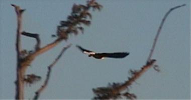
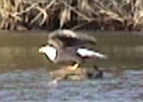
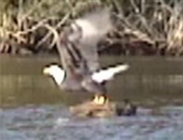
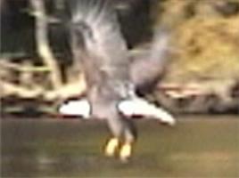
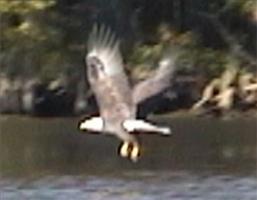
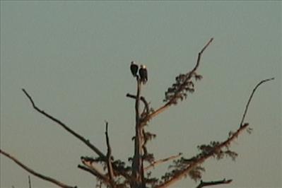
Here are two more male bald eagles!
|
Westover Plantation from the water
|
|
|
|
|
|
|
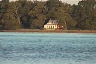
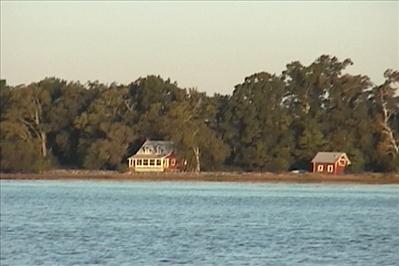
In the morning light this little house on the James looked beautiful. What a view they have! This part of the River must never flood because it looks like they are only a few feet above the water, which was at high tide.
|
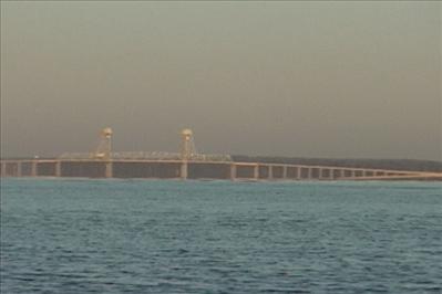
This is the bridge at Jordan point. Just past this bridge the James River forks, to the south it becomes the Appomattox, to the North it is the James River all the way up past Richmond
|
|
|
|
|
|
|
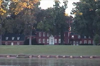
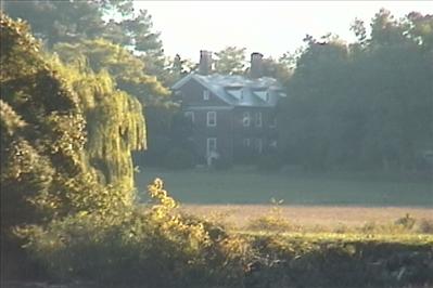
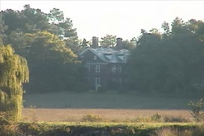
Berkley Plantation, our Destination!
|
We put up the sails, heading south with an agreeable wind and tide. It was a great sail at over 5 knots the whole way.
|
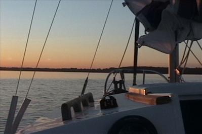
Along the way, it began clouding up. I put a reef in the mail sail, which worked great. Sailing keeps you busier than motoring and I didn't take any video why we were sailing. Once we passed the Chickahominy River, I knew we had enough fuel to get back and decided that if we wanted to make Jamestown Island before dark, we would have to motor the rest of the way. It was about 5 PM when we took down the sails.
|
|
|
|
|
|
|
|
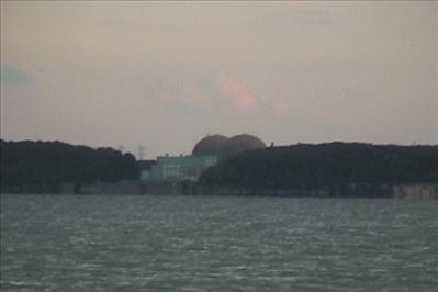
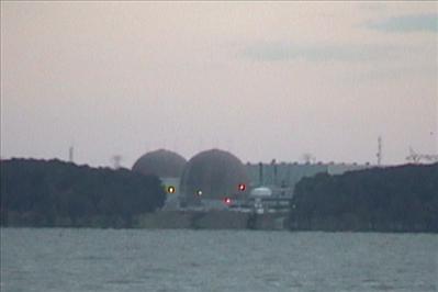
We were now back in the vicinity of Jamestown Island. Across the river from Jamestown Island is the Surry Nuclear power plant; it was getting close to dusk when I took the shots below.
|
|
|
|
|
|
|
|
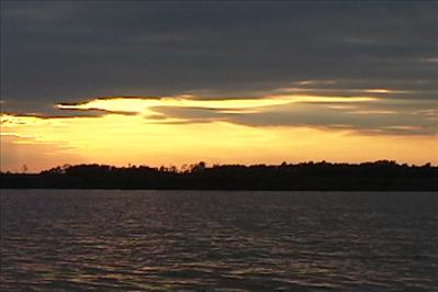
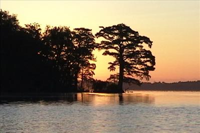
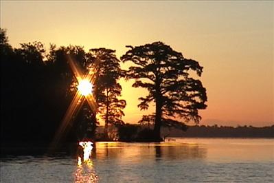
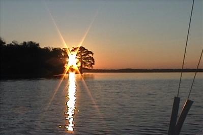
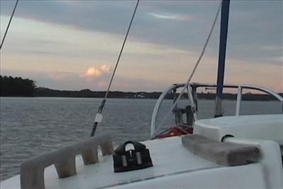
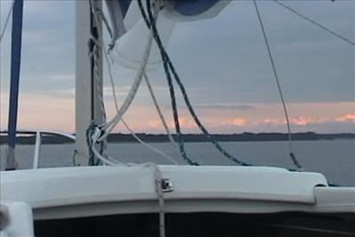
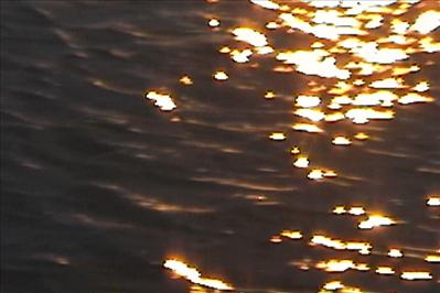
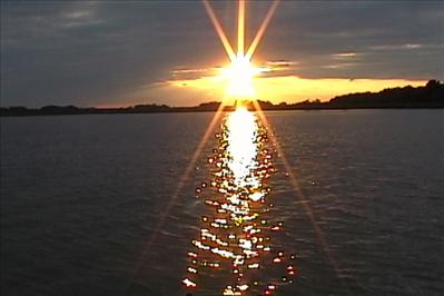
A few shots of the beautiful sunset.
|
|
|
|
|
|
|
|
Sunset was at about 7 PM and we finally made it to our anchorage in the Thoroughfare at Jamestown Island at about 7:35; it was starting to get pretty dark. We had a good GPS track, pretty deep water and anywhere in the Thoroughfare would have been satisfactory if we decided to stop there for the night. But as can be seen we used every bit of daylight!
|
|
|
Saturday
|
|
|
|
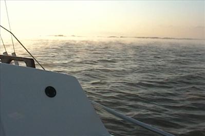
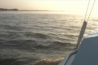
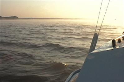
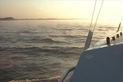
Saturday morning, our last day on the water and the weather forecast was pretty gloomy with winds forecast to be up to 20 knots. The Sunday forecast was for gale force winds of over 30 knots so we wanted to get off the water as soon as we good. First thing in the morning, we got underway. Steam was rising from the water and wind was blowing across our bow, it was kind of surreal and ghostly looking. You can't see it very well here but it was pretty and somehow ominous at the same time.
|
|
|
|
|
|
|
|
Given the dismal forecast, I wasn't sure what to expect. I tried to hug the shore (on the windward side) as much as possible, keeping an eye on the charts unless I decided I wanted to duck in someplace. I thought about heading into College Creek at Fort Eustis, but we were doing just fine and we were only an hour away from the Warrick River.
The worst part of the trip back was probably the channel near the ghost fleet. Due to some kind of pier on the north side of the reserve fleet, you had to use the channel if you wanted to stay on the north side of the river. The water in the channel was over 60 feet deep and at this point in the river the swells were close to three feet. The tide was running against us creating waves and eddies and sometimes waves would kind of break around us. It was kind of exhilarating to surf down the small waves. However, a few times the stern wanted to get away from me and I had to stay on constant alert while I had the helm. As long as I was paying attention and anticipating the waves, we didn't have any problems. But when I tried to steal a look at the chart the helm would sometimes wander and the stern would start to go around and we would end up somewhat sideways in the current. But, those conditions only lasted for about 45 minutes and soon the James widened and we had an easy time making the safety of the Warrick River.
On the way up the Warrick River, we saw some recreational boats heading out to fish. With small craft advisories were up, I couldn't believe anyone would be heading out to fish. We even saw two small "John Boats" with small kids in life jackets heading out. Fortunately, after we docked I noticed that those "John Boats" had come back. I was glad to see it because I was worried about those little kids.
|
Here is the track of our entire trip. The trip log on my GPS showed that we cover 131.5 miles on the water! As I've said many times before, time on the water really goes fast. I'm ready to go again.
|
|
|
|
|
|
|
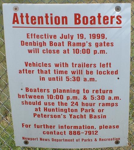
It was about noon when we got off the water. When I got to my truck it had a warning ticket on it. I later called the park service and found out that I should have notified them that I would be leaving my truck overnight. There wasn't any fine so it was no problem. Here are the numbers if anyone is planning on using Hoopes Landing anytime soon.
|
This page last updated on 9/3/2012 12:53:39 PM. If you have comments or suggestions, email me at webmaster@jscheetz.com